We’re always out there, looking, checking, researching and trying to locate a new prospect or deposit. It’s always a question as to where to start. One day we’re headed down to the river to do some panning, sluicing or dredging. Looking for that spot or location where someone else has missed or where the high river flooding moved in some gold that’s just waiting for us to find. Maybe we’re breaking bedrock to get to the elusive gold that’s been there a long time.
There are many methods on finding opportunities and in the case of this story, it’s researching and locating an old hardrock mine. Its history suggests the possibility of not only finding some ore that contains some high values, but also the chance of further prospecting the vein system to a new location for some serious mining. If we know the strike and dip of the vein systems, we might find a new logging road cut that has exposed the vein and the chance of some really high grade, visible gold ore.
I’ve know of this old hardrock mine for several years, knowing it dated back to around 1890 or so, and that it was closed down close to the beginning of WW II. A friend of mine, Frank Sullivan, knew a lot about it and he gave me directions on how to get there. The location of the mine was in the high country, well above the historic mining town of Foresthill, in Placer County, California. Once the elevation got to around 5500 feet I had to turn onto a dirt road going towards an old town site of Deadwood, which now only has a cemetery there. He also gave me instructions on several more turns off this road and finally down into a canyon to the actually site itself. Sounds simple enough, right? Well, I took several turns off the road and chased them way too far. One turn took me onto an old logging road where the growth of bushes and small trees pinstriped my four-wheel drive Geo badly, but it’s used to that. Wrong road and back again. This went on for two hours until I finally came to what appeared to be the right road. I went down the road and made a left turn and wound around the mountain. Then it was float quartz everywhere, obviously coming off the hillside. Then I came passed several small outcropped vein systems and then to two enormous, rusty water tanks, each standing about 25 feet high and 30 feet in diameter. Surely I was on the right track. In 400 yards I drove right into an old town site, and I mean old, because every house was flattened down completely to the ground. The heavy 15 foot winter snows in this area took their toll. I found about eight house sites but no stamp mill in sight. I checked my USGS map again, and realized I was at a location called the “Osborne” and that the Herman Mine was below this site by about 400 feet elevation and on a different turn off this dirt road. OK. Back track and down and around I went. The road was dropping in elevation and I came to a bluff overlooking the canyon, and the road from there down looked really rough. By now it was starting to get late and I knew I had to head back. I was running without my spare tire (which was being repaired from another excursion) and I knew this was not very brilliant. Reluctantly I headed back home.
Two days later I was back with George Grant, who had just been there for the town of Foresthill, which wanted to secure at least one or two of the banks of the stamp mill (5 stamps per bank) to set up in the town. I went with George in his jeep. Guess what? We drove just past the last point I had stopped and in five minutes we were at the mill site itself. If I had just gone another two tenths of a mile I would have found the mill. That’s the way it goes with prospecting sometimes.
After this trip I made several more, did a lot more research, and brought in several other prospectors to help me check the area out. There’s always a value to having others help because there are a lot more eyes looking and searching ground that one person just couldn’t do in a reasonable time. Prior to our going back another friend sent me an e-mail about a book in the Foresthill Museum that was about the mine and another prospector picked it up for me. The pamphlet was titled “The Herman Mine, 1894-2002, A Collection”. The author was John Wills – Moderator. This was our guide for much of the checking we did. The pamphlet was a collection of articles, e-mails, and a geologic report done in 1980 for the owners of the property at that time. Much of the research in the pamphlet was done by Lewis Swindle and he did a super job on collecting information from various sources. John Will’s father had the mine for a period of time until around 1934.
With this data and a team we headed in to make some sense of all the data we had and to locate the tunnels, sites, ore, and anything else we could put together. Overall we made four trips to the approximately 600 acres of territory consumed by this project. Here’s our conclusions.
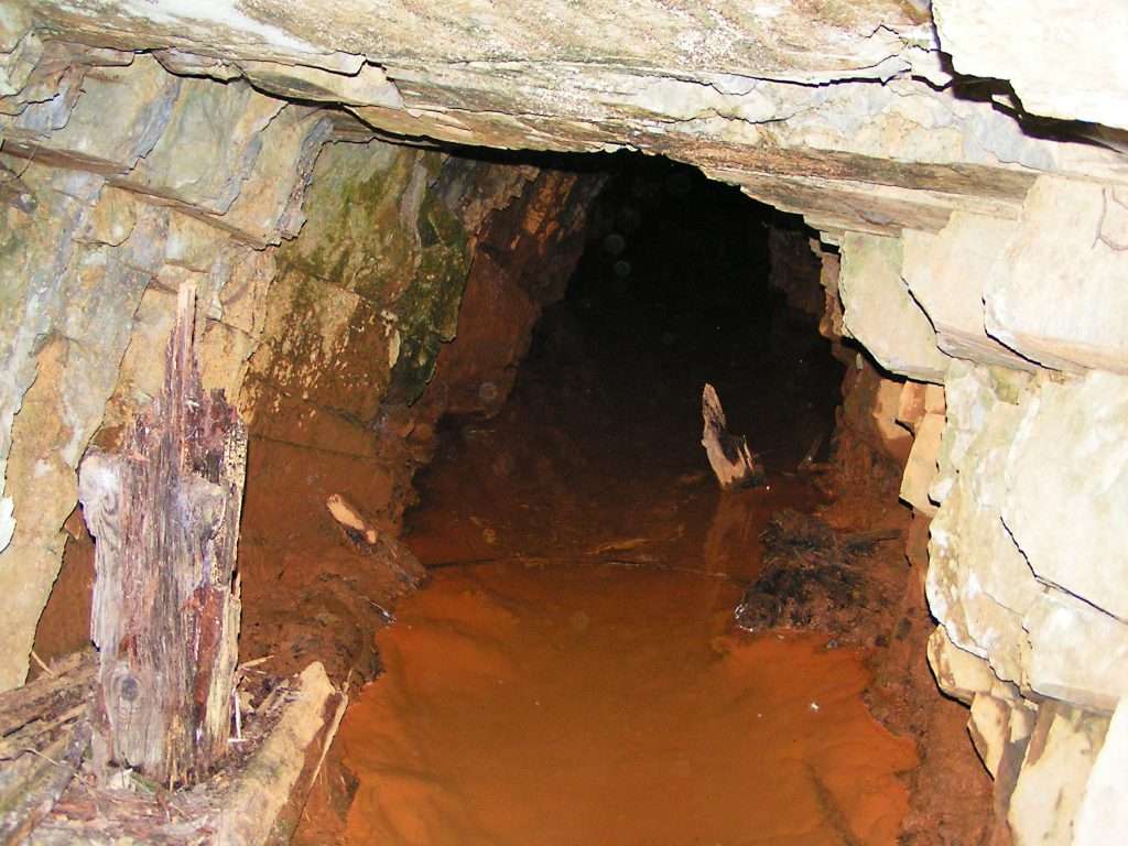
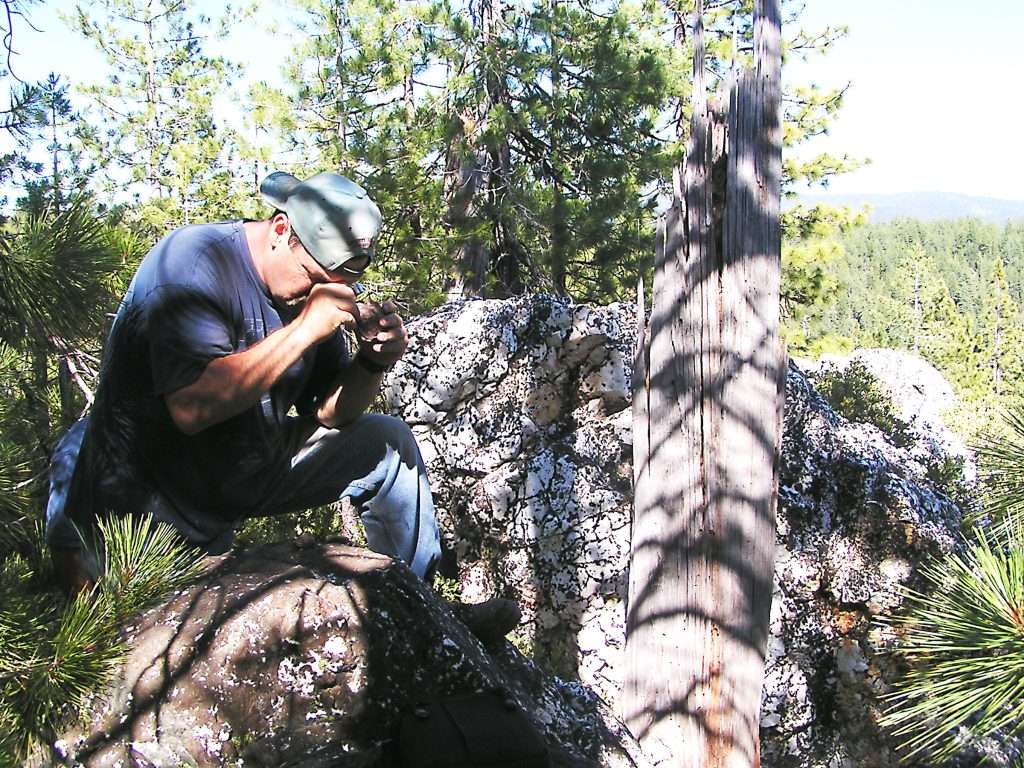
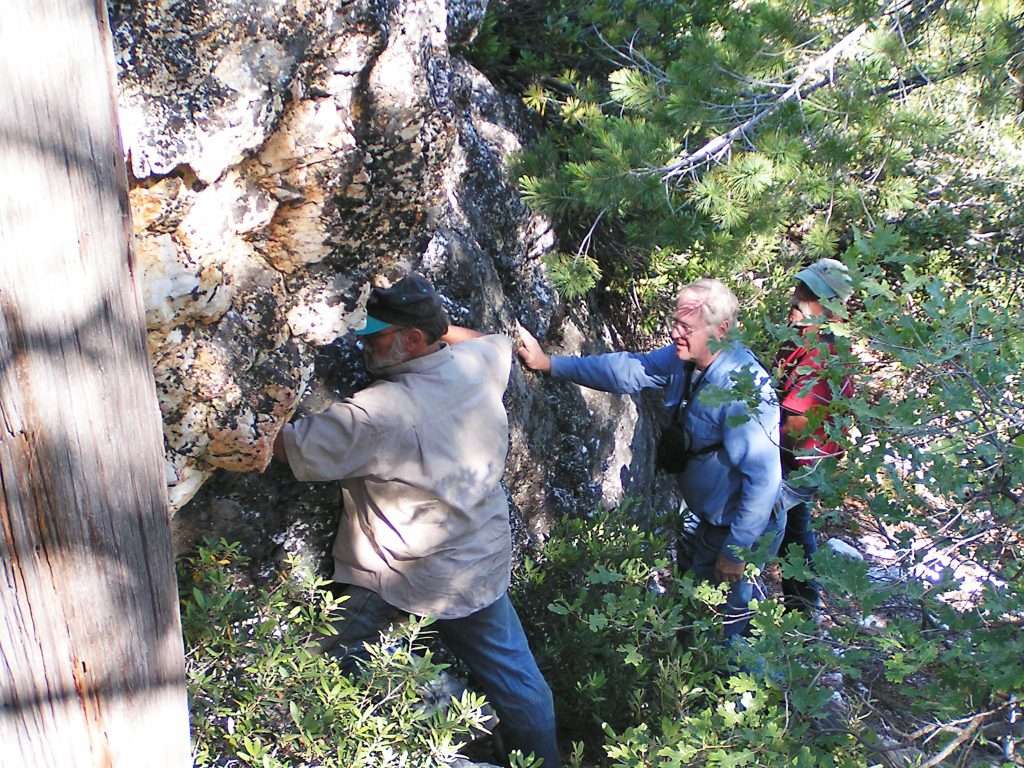
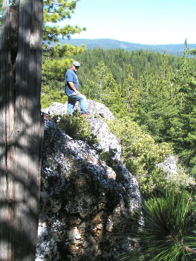
Mr. Osborne first found this deposit around 1894 and based upon his studies of the vein systems there, drove a shaft down 100 feet and hit very high grade ore. This started the town site where all the flattened homes were that I first located. This was a booming mining project and we located two tunnels where they had driven into the mountain to intercept the high grade ore. Our biggest discovery happened on our second trip when one of our team members spotted a huge outcropping of quartz up the mountain well above the Osborne town site. Up we went and to our amazement there was the apex of the quartz system, outcropping on the hillside, standing 15 to 20 feet tall, with a visible strike of over 150 feet. The entire hillside had eroded away leaving the quartz vein system exposed, showing not only the strike, but the dip of the vein as well. This vein system showing here was 6 to 8 feet wide, and is geologically designated as part of the East Belt of the Mother Lode. I’ve seen this same system and mined it for almost two years near El Portal, just east of Mariposa. This outcrop was amazing and one of the best I’ve seen of a hard rock structure.
With the knowledge of this quartz outcropping, and its strike and dip, every thing we had seen or read fell into place. Now we knew why the Osborne tunnels were located as they were and how the history developed for this mining project.
The main quartz vein was called the “Osborne ledge” with two other parallel systems trending in the same direction, one north and one south of the Osborne vein. The strike outcropping was primarily northeast and southwest, although the reports were confusing about this. The dip was running about 70 degrees, trending east. There is also a fourth vein, with the strike due north.
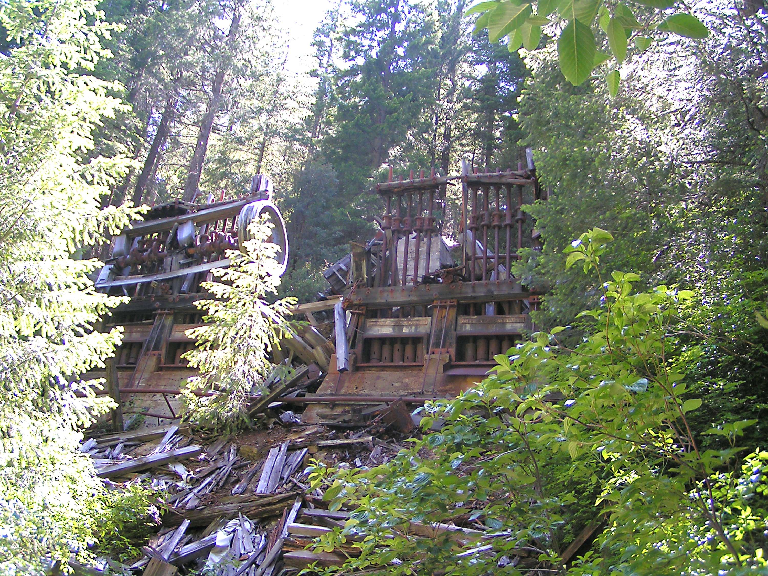
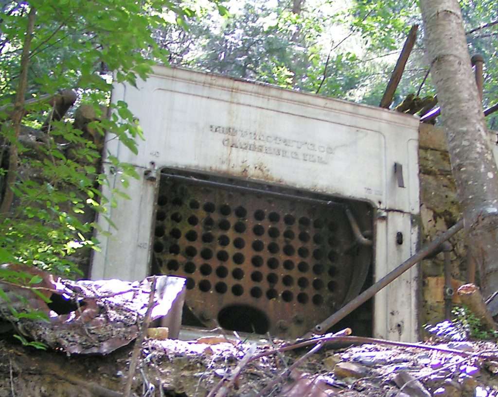
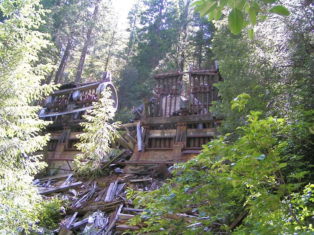
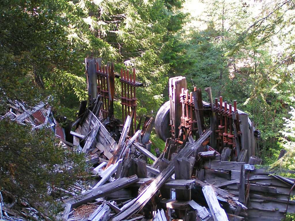
In 1895 the Herman Mine (formally the Osborne) was running a ten stamp mill. The mill was housed in a building 76 feet long, 65 feet high and 27 feet wide. This building contained the stamp mill and a concentrating room with four concentrators, using copper plates 4 ½ feet by 12 feet. The ore bin was 13 feet x 15 feet and 15 feet deep. The stamps were driven by a steam powered plant, using 600 cords of wood per year. Now that’s a lot of wood for each year of operation and in the long run, according to one opinion, the use and later scarcity of wood became a major factor in the profitability and subsequent closing of the mine. The mine had eight men working full time just to provide the wood for the steam plant.
In March 1896 the mine shipped out 300 ounces of gold from the February production. The March production was 340 ounces, and the trend was continuing upward.
The veins were being stoped out and it was decided rather than sinking on the vein system, they would drop further down the mountain with a new tunnel to intercept the vein system again for processing. This new tunnel hit high grade ore, running over two ounces per ton. While this was in process, and looking ahead for future ore, they also started another tunnel 400 feet lower, and this eventually became the site for the 30 stamp mill that is presently in place today.
In June of 1907 the Northern California Mining Company took over and employed 60 men. The 30 stamp mill was ordered from Joshua Hendy Works, in San Francisco. In August 1907 the mill was set up and electrically powered by a steam plant. Again wood became in high demand, and the vein was paying very well, in some cases running over four ounces per ton. This was super high grade and promised a long term future for the mine.
The mine operated full time until around 1912 and after that on and off up until 1937, when it closed for good. The production in 1912 was good, and at one point took out over 300 ounces in one 18 day period.
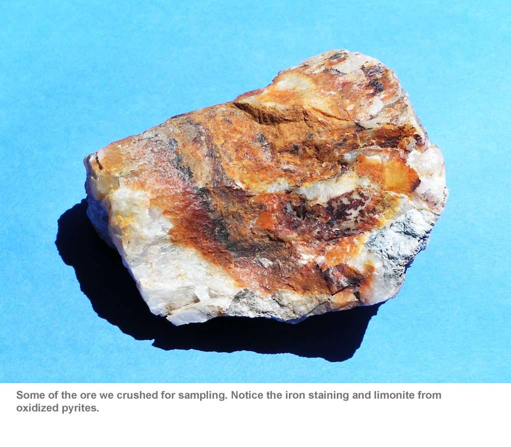
From all the reports, the best ore for this mine was described as quartz with limonite, and sometimes containing galena, a lead sulfide (PbS), and sphalerite, a zinc sulfide (ZnS). The limonite is best described as quartz with oxidized sulfides, having shades of brown and sometimes a yellowish cast.
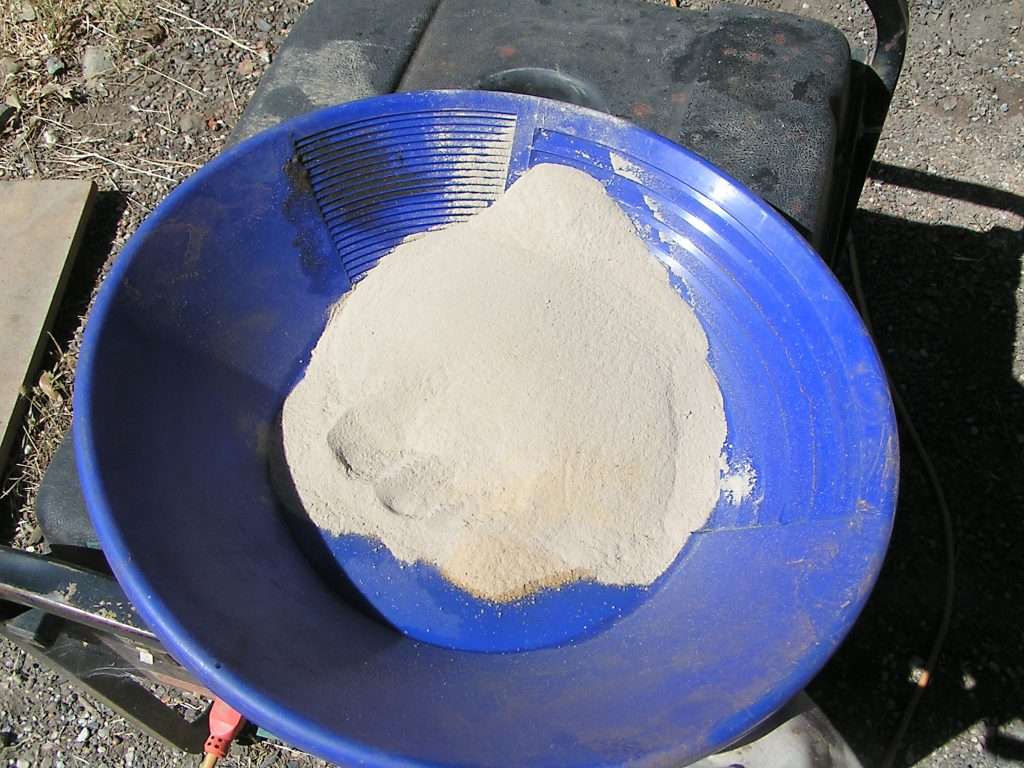
With this information, we collected samples with this designation, with the purpose of simply crushing them and panning them out to see if free gold was present. We simply wanted to identify the ore so we would know what to look for in the future in prospecting the vein at other potential locations. We did this, crushing the samples down to a minus 60 screen size. Just as the records indicated, the samples we took showed some free gold, about the size of the diameter of pencil lead. There wasn’t much gold, and in some samples we had none. Others showed high concentrations of pyrites and in one sample some nice color along with it. Keep in mind there wasn’t much color overall but enough to indicate the obvious presence of gold bearing ore. We didn’t assay the samples and could have and therefore got some quantitative numbers, but that wasn’t our interest.
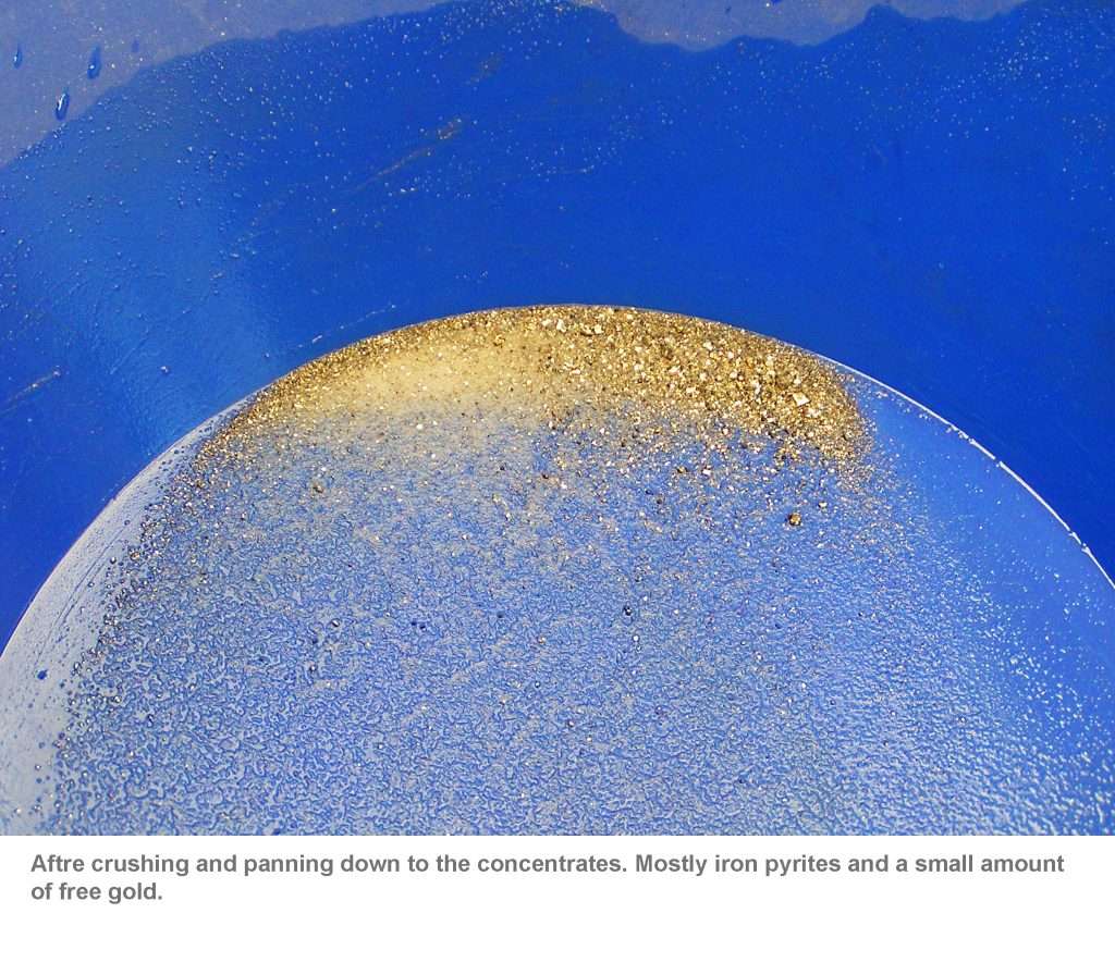
Historically, there was one report stating “sulfhurets” were being prepared for shipment to San Francisco for “reduction.” From our sampling, free gold was present and we don’t know the percentage of free gold versus gold bearing sulfides. None of the historical reports I saw identified this percentage division.
There was also one report indicating they did sink on the vein from the end of the lower tunnel for a distance of 600 feet, with a level and work at each 100 foot level going down.
Today the property is privately owned by a timber company and the 1980 geological report that was done for them indicated the best future for the property was timber, not gold. Now perhaps the geologist was correct in his evaluation, but I also found a statement in his report that led me to question his mining knowledge. One of his report statements concerning the ore was that sometimes the “tails” was greater than the “heads.” As miners we know the “heads” is the value of the ore going in and the “tails” is the losses after processing. This is possible but very unlikely.
With all this in mind, this property may indeed still offer some potential. However, our objective was to understand the mine and its ore, and a possible direction for more prospecting outside this property. With the strike and dip of the vein, and an understanding of the paying ore in this part of the system, we’re off and running to see if we can pick this vein system up again in an area we might be able to mine for ourselves.
This mine was truly one of the best hardrock mines in this part of the country and we’ve learned a lot from this prospecting adventure. Now let’s see where it takes us!
Thanks
Don
Sources
Wills. John. The Herman Mine 1894-2002 A Collection.
Within this collection are reports by Lewis Swindle, whose research took reports from the Placer Herald newspaper;, Auburn Journal newspaper; Mining and Scientific Press; 13th Report of the State Mineralogist 1895-1896; 14th Report of the State Mineralogist; 32nd Report of the State Mineralogist 1936; California Mining Journal October 1935, November 1935, October 1936, and July 1937.
W. P. Johnson, Consulting Geologist Herman Gold Mine July 9, 1980.